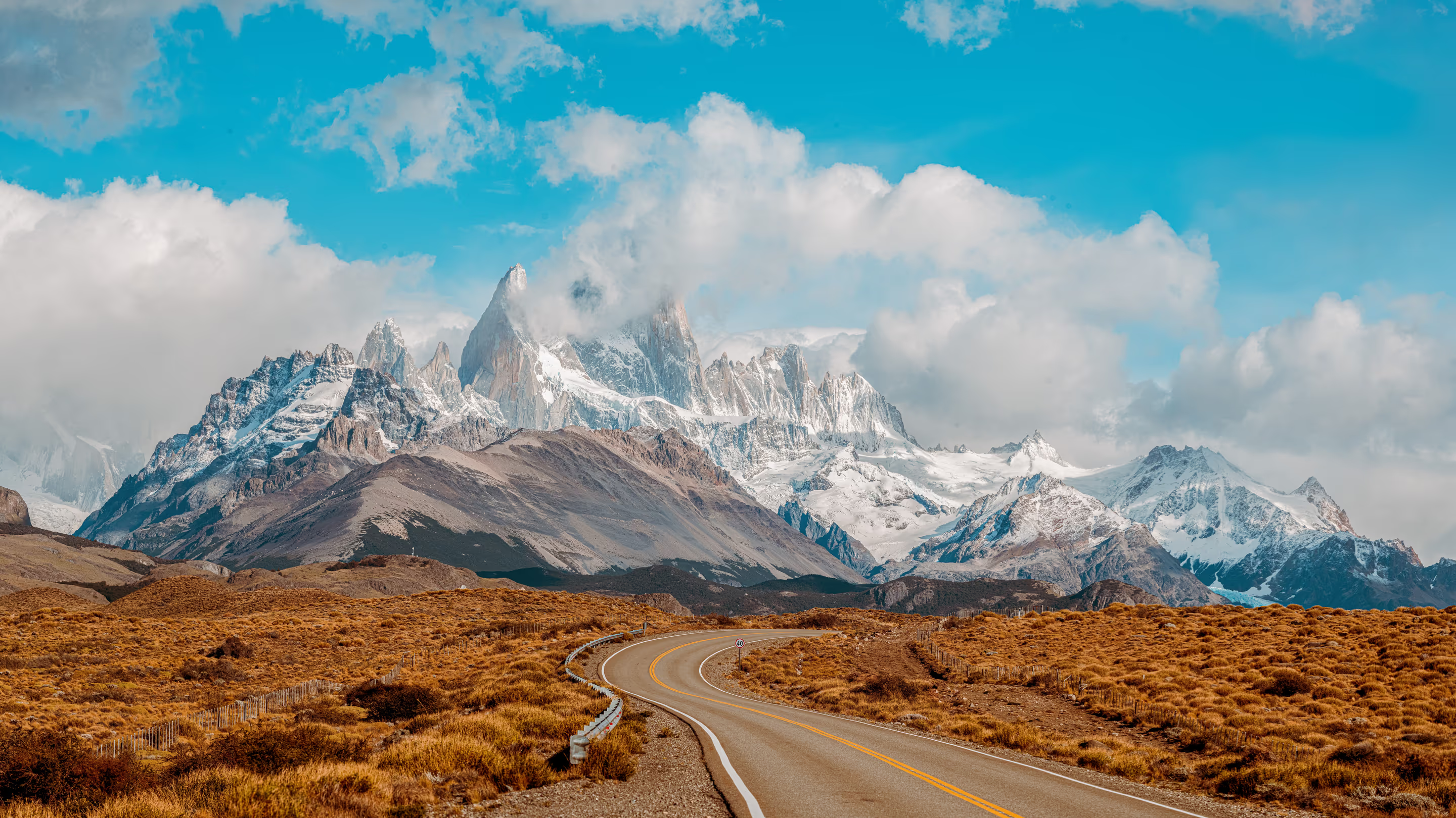
The road leaves the lake, crosses open country and turns towards a wall of mountains. Make the transfer a part of the journey, with a useful stop and enough time to arrive well.
El Calafate and El Chaltén serve different parts of Los Glaciares National Park. One is the gateway to the southern glacier and lake excursions; the other is a mountain village with major walking routes nearby. The paved connection uses Provincial Route 11, National Route 40 and Provincial Route 41. The national park's current access page gives about 220 kilometres between towns, though summaries vary with endpoints. Think in terms of a substantial transfer, not a quick local hop. The road can be beautiful in its own right, particularly as open steppe gives way to the mountain approach, but stops and conditions determine how much of the day it takes.
01
Choose nights before choosing transport
Allocate the glacier days to El Calafate and the walking days to El Chaltén, then put the transfer between them. This prevents the road from being treated as spare time that can absorb a full excursion at either end.
02
Decide whether stops are part of the plan
A scheduled bus is a practical connection, while a private transfer or rental vehicle offers more control over pauses. If a stop matters to you, establish that it is included or feasible. Do not assume a scheduled service will wait for an independent outing.
03
Keep the arrival modest
Arriving in El Chaltén with time to settle in, collect current trail information and eat well is a good result. A shorter walk may fit, but it should remain optional. Save the larger route for a day that begins from your accommodation.
La Leona area · Open water and mountains across the horizon
Lago Argentino towards the north
Read the country from the road.
The connection opens out into the dry eastern side of Patagonia, where low vegetation and large skies contrast with the mountain forests farther west. Water gives the route its structure: Lago Argentino, the La Leona river country and the approach towards Lago Viedma sit within the wider journey between the two bases. On a clear day, the distant mountains can draw attention for a long time before arrival. Let the landscape explain that distance. A designated pull-off is a better place to take it in than a hurried stop on the road, and cloud can make the broad country just as compelling as a fully revealed skyline.
01
Use the map to understand the route
The road does not follow one continuous lake shore. Notice when it crosses open steppe, approaches water and turns west towards the mountains. That larger pattern makes the drive more interesting than watching only for the next attraction.
02
Keep wildlife observation unforced
Guanacos and other animals belong to the wider steppe landscape, but an encounter is never guaranteed. Stay alert while driving and give animals space. A distant sighting from a safe stopping place is enough; there is no reason to pursue one.
Towards El Chaltén · The road beneath Fitz Roy
A road stop and a separate excursion
Know which stop you are making.
The La Leona area is a useful reference point along the corridor, with a roadside parador and access to separately arranged outings in the surrounding country. The La Leona petrified-forest excursion is especially important to distinguish from a brief refreshment stop. The municipal description allows around three hours of walking among eroded terrain, fossil material and petrified trunks, within a longer outing that includes transport. Its excursion page provides the booking/contact pathway. It is not a roadside display you can casually inspect while a bus waits. Choose either a simple pause on a transfer or a properly arranged geological outing. If the latter matters, build the day's transport around it.
01
A café stop depends on the service
Confirm whether your chosen transport stops at La Leona and what is open on the day. Carry water and food regardless. A familiar name on an itinerary is not a guarantee that every traveller will have the same pause or facilities.
02
Treat the fossil landscape as a visit
If booking the petrified forest, ask about the exact starting point, walking effort and whether onward travel to El Chaltén is included. Keep all fossil material in place. A specialised excursion deserves more than a rushed gap between connections.
El Chaltén · Walkers entering the mountain landscape
The turn towards El Chaltén
Arrive with energy for tomorrow.
The final approach brings the mountains much closer, and the scale of the town becomes clear beneath them. This is the moment to let the road journey end rather than immediately beginning a demanding hike. Find the accommodation, arrange the next day's food and visit the local information points. If daylight, conditions and energy suit, a shorter viewpoint or a walk around the village can round off the day. The major Fitz Roy and Torre routes are better approached with an early start from town and a plan based on current conditions. A comfortable first evening improves the whole stay that follows.
01
Choose tomorrow's walk after arrival
A fixed idea formed in another town may not suit the conditions you find. Ask for the current trail map and advice, then decide between a longer route and a lighter alternative. Keep more than one day available for your main objective.
02
Reserve the longer valley outing separately
Lago del Desierto lies beyond El Chaltén on a gravel road and involves another set of transport choices. It is not simply an extra stop along this paved transfer. Give it a separate day if it belongs in the stay.
The main decision is how much independence you want between the two towns.
01
Scheduled bus
A straightforward connection between bases.
Compare the actual departure and arrival points, baggage arrangements and any published intermediate stops. A bus works well if you will walk or use local transfers in El Chaltén. Use the Taqsa/Marga bus search for current options on your dates and book the service that leaves a useful arrival window rather than chasing the earliest possible start.
Allow time to reach the terminal.
Keep essential layers and food with you.
02
Private transfer
Pay for the flexibility you will use.
A private vehicle can be useful for a group, a particular pickup address or agreed scenic stops. Ask what the price includes and whether waiting time or a detour changes it. A direct transfer and a guided sightseeing journey are different products, even when they cover the same road.
Agree on stops before confirming.
Make the final destination and baggage needs clear.
03
Rental car
Think beyond this one drive.
Hiring a car may suit a wider Santa Cruz road trip, but it can spend several days parked while you walk from El Chaltén. Compare that full cost with the value of independent stops. Check fuel arrangements, insurance, return location and permission for any later gravel-road journey.
A one-way rental may have separate conditions.
Do not base the plan on an unconfirmed fuel stop.
04
Airport connection
Use the airport's actual pickup.
Some services connect the El Calafate airport with El Chaltén, avoiding a town visit when the schedule fits. Confirm the specific pickup, how a delayed flight is handled and whether luggage collection leaves enough time. For the reverse journey, allow a sensible margin rather than treating the road travel estimate as a guaranteed arrival. Use the airport-transfer guide to distinguish an onward El Chaltén pickup from a transfer into El Calafate.
Use the booking's precise departure point.
A late flight may make a town night the calmer choice.
05
Wind and winter
Leave room for conditions.
Open stretches can be windy, and winter weather can affect road and driving conditions. Check Santa Cruz road conditions and follow any restrictions. A nominal distance is useful for orientation, but does not establish the travel time on a particular day. Build the itinerary so an inconvenient delay does not immediately threaten a major booking.
Use designated stopping places.
Prefer an unhurried daylight journey where practical.
06
The return journey
Protect the final night.
After several mountain days, leave enough time to pack, eat and reach the departure point. If connecting with a flight from El Calafate, consider returning the day before when the schedule is tight. An extra town night can also hold a missed cultural visit or a relaxed dinner, making the buffer useful rather than empty.
Keep a major hike off the flight-connection day.
Use El Calafate's nearby visits for flexible time.
Useful visitor information
Plan with the latest local details.
Official and specialist information for the places in this guide.