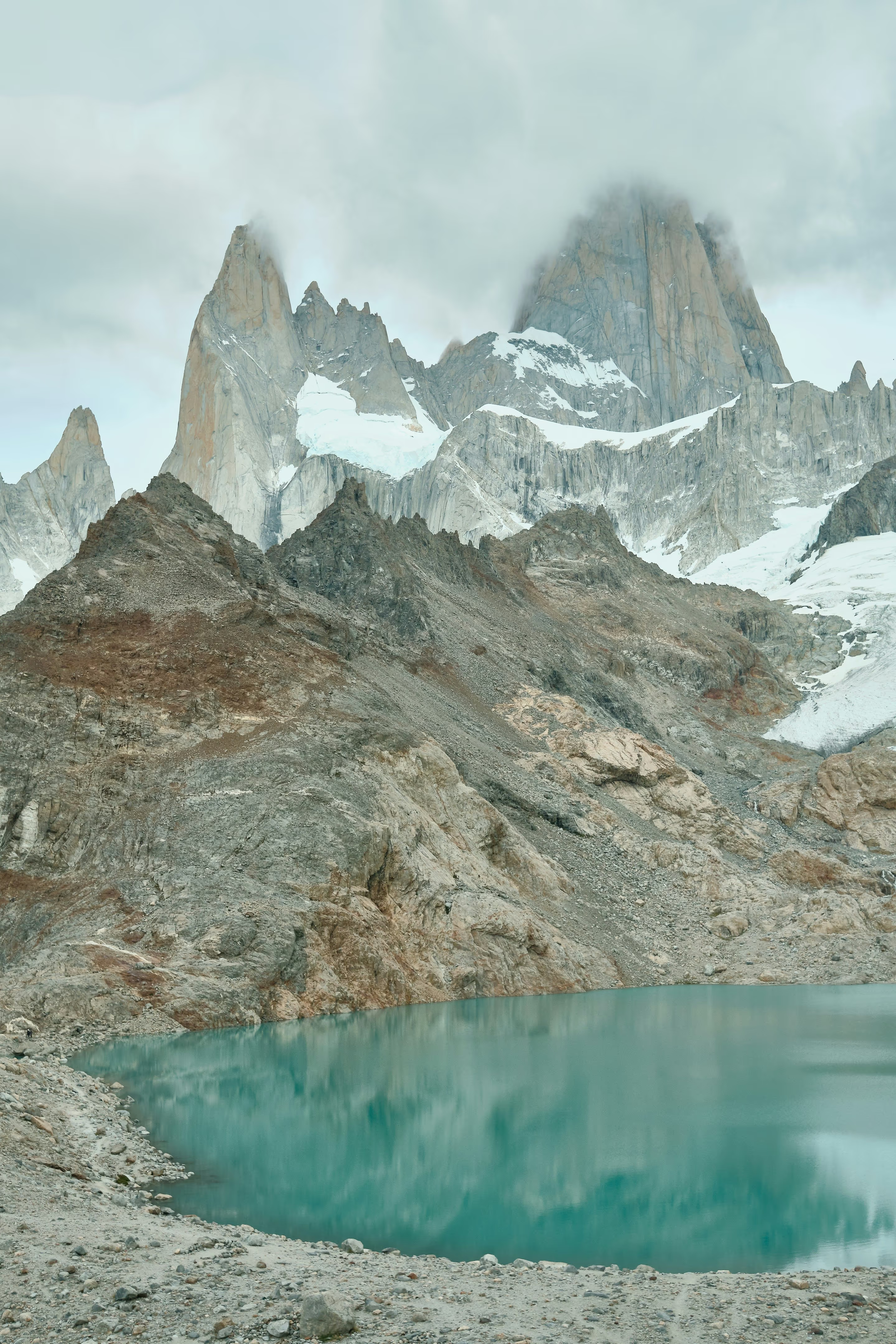
Forest gives way to open mountain country. The trail steepens. Beyond the moraine, a glacial lake sits beneath the granite walls. Make room for the whole walk, not only the photograph at the end.
Laguna de los Tres is one of El Chaltén's major mountain walks, reaching a lake close beneath the Fitz Roy massif. Its appeal builds gradually: valley views, native forest and open ground lead towards a much steeper final ascent. That sequence matters when deciding whether the walk suits you. The national park's trail map marks the town route at about 10 kilometres each way, while other official summaries give a longer total. Use the current map and confirmed start point for your plan, and think in terms of a full day of roughly eight or nine hours of walking, potentially longer with pauses or difficult conditions. This is a route to prepare for before arriving at the foot of the final climb.
01
Choose a day with room around it
Stay in El Chaltén before and after the walk. A flexible morning and an unhurried return remove a transport deadline from an already demanding day. Put the route on the most suitable day of the stay, rather than fixing it before you know the conditions.
02
Understand the effort you are choosing
The route includes sustained walking before the steep upper section. Descending that section and returning to town remain part of the commitment. Judge the whole day against the group's experience, pace and current condition, not only enthusiasm for the final view.
03
Give a shorter objective equal standing
Laguna Capri and Mirador Fitz Roy offer a strong introduction to this mountain country without the same upper-trail commitment. Decide that alternative in advance so the day still has a clear and worthwhile purpose if the high lake is unsuitable.
El Chaltén · Walkers on the autumn Fitz Roy approach
The lower trail and native forest
Let the approach unfold.
The town approach begins at the northern end of El Chaltén and climbs towards the Fitz Roy viewpoints and Laguna Capri area. Forest provides a different kind of interest from the open mountain scene: tree trunks, filtered light and seasonal colour make the walk more than a means of reaching the lake. The trail then continues towards Poincenot, a named camping area within the wider route network. Use the APN northern-sector trail map to understand the junctions before setting out. The marked choices around Capri are not an invitation to improvise a shortcut, and an appealing side route still adds time to the day's return.
01
Capri changes the scale of the outing
Choosing the lower lake makes the forest and shoreline the destination. It can suit a lighter day or a mixed-ability group better than the full route. Confirm the particular circuit, including the return branch, on the current map.
02
Notice the distance already behind you
The more moderate terrain beyond the first climb can make the upper objective feel deceptively close. Use your actual progress, the remaining daylight and the group's energy when deciding whether to continue.
Laguna de los Tres · Rock, snow and the upper mountain basin
Beyond Poincenot
Save something for the steep ground.
After the Poincenot area and river crossing, the approach changes into a much more concentrated climb towards the lake. Loose and uneven ground, steep gradients and exposure make this the decisive part of the route. The national park specifically highlights caution in rain and wind. Snow or ice can alter it further, even when the lower trail has felt straightforward. The APN map’s outward sequence is Laguna Capri at 4 kilometres, Poincenot at 8 kilometres and Laguna de los Tres at 10 kilometres from the route origin. These are cumulative waypoint distances, not three stages to add together; the demanding climb comes after the Poincenot approach, and the same ground must still be descended on the return.
01
Make the decision before the hard section
Agree on a turnaround plan before leaving town, then reassess it honestly at the upper approach. If conditions, timing or energy are wrong, the kilometres already completed are a reason to return with care, not a reason to press on.
02
Keep the descent in the plan
The lake does not mark the end of the physical work. Leave enough time and energy for careful footing downhill and the longer return through the valley. A long stop at the viewpoint needs to fit inside that calculation.
Fitz Roy massif · Snow and granite above Laguna de los Tres
The granite and the glacial basin
Stay still beneath the walls.
At the lake, the relationship between water, snow and granite becomes the main event. Cloud can reveal one part of the massif while concealing another; the shape and colour of the basin can change the feel of the view within a short pause. It is worth having time to settle, add a layer and look rather than immediately searching for another vantage point. Keep to permitted paths and established viewing areas. The surrounding slopes and glacier are a different environment from the walking trail, and a lake visit does not require an extra scramble to feel complete.
01
Let the photograph fit the visit
Look for light and texture from the safe ground you have already reached. A dramatic image does not require approaching an unstable edge or stepping onto snow you have not assessed. Leave others space to enjoy the same view.
02
Know what the map actually shows
Laguna Sucia appears in the neighbouring basin on park maps. It is a separate feature of the landscape, not an automatic descent to add to this walk. Follow the designated route and ask the park about any additional objective beforehand.
Use this guide to choose the outing. Use current national park information to confirm the route, access and conditions for the day you will actually walk.
01
Time and distance
Use one confirmed route description.
The standard town approach is a long return walk with a steep final section. Published totals differ because summaries and starting points vary. Confirm the current mapped route rather than combining the shortest distance from one description with the fastest time from another. Include the walk from your accommodation, breaks and the return to town in your day.
Allow more than a moving-time estimate for the full outing.
Choose a start and turnaround plan suited to daylight and current conditions.
02
An alternative start
El Pilar is a separate arrangement.
The wider map includes an approach from the Río Eléctrico and El Pilar direction, with the Piedras Blancas area along that network. It can change the shape of a day, but it also introduces transport and different route details. Only choose it after confirming current access, the exact trail and a reliable transfer. It is not a simple way to make the final climb disappear.
Arrange the outward transport before committing to a different trailhead.
Confirm where you will finish and how you will return.
03
Clothing and supplies
Prepare for the upper basin.
Bring suitable walking footwear, food and water, and layers for wind, rain and a cold stop. Carry the current map offline and a light even when planning a daylight return. The park warns that trail communications are limited. Get local advice on water arrangements and any additional equipment required by the conditions.
Put essential items where you can reach them during the walk.
Do not rely on a phone signal to recover an unclear route choice.
04
Season and access
A snow photograph is not an access report.
The lake and upper trail can hold snow or ice outside the coldest months. Autumn colour lower down does not establish the condition of the final ascent. Confirm the route with the visitor centre, including current entry arrangements, and read the current APN registration guidance. The park requires trail registration from May to September, as well as separate registration for remote routes and climbing. Paid park admission is a separate requirement: use the El Chaltén park-ticket planning notes and APN’s current ticket link to select the correct access. Trail registration does not replace admission.
Use conditions at the upper trail, not only the town forecast.
A winter visit may require a different objective and professional guidance.
05
Camping plans
Poincenot changes the logistics.
An overnight itinerary can divide the distance differently, but it adds camping equipment, food, current site rules and another set of decisions. Do not assume that a camping symbol means an unrestricted overnight stay or a serviced mountain lodge. Confirm the arrangements with the park before booking the rest of the trip.
Use only permitted campsites and follow the current rules.
Keep the day-walk plan separate from any overnight extension.
06
The next day
Choose recovery with a view.
After a demanding outing, a shorter walk, a village afternoon or the lower forest can be a satisfying change. Laguna Torre is another substantial day and deserves fresh energy, even though its terrain differs. Give El Chaltén enough nights to choose the order thoughtfully rather than treating the two famous lakes as consecutive compulsory tasks.
Use Capri as an alternative objective when the upper route is unsuitable.
Return to the town guide for shorter outings and a balanced stay.
Useful visitor information
Plan with the latest local details.
Official information for the places and routes in this guide.